I haven't been able to get out mapping much recently, but a lovely day tempted me out. I did some OS Locator name chasing and as is often the case, the OS Locator names led me to a development with far more changes than just the ones OS Locator picks up. I will need to return again as the development grows in Kingswood. There's lots of area obviously earmarked for development but presumably waiting for the cash generated from selling the current houses to fund the next stage.
I then went to look at a newly opened crossing of the river Hull, Scale Lane bridge. It is a pedestrian and cycle route across the river very close to the museum quarter. It lead directly to a large fairly new hotel and towards The Deep, Hull's aquarium, or Submarium as they call it. If you are in the city take a look at The Deep, it is interesting. You walk slowly down to see lower and lower levels in the aquarium and then a glass lift carries you from the bottom back to the top to looking out at the large aquarium as you go.
 |
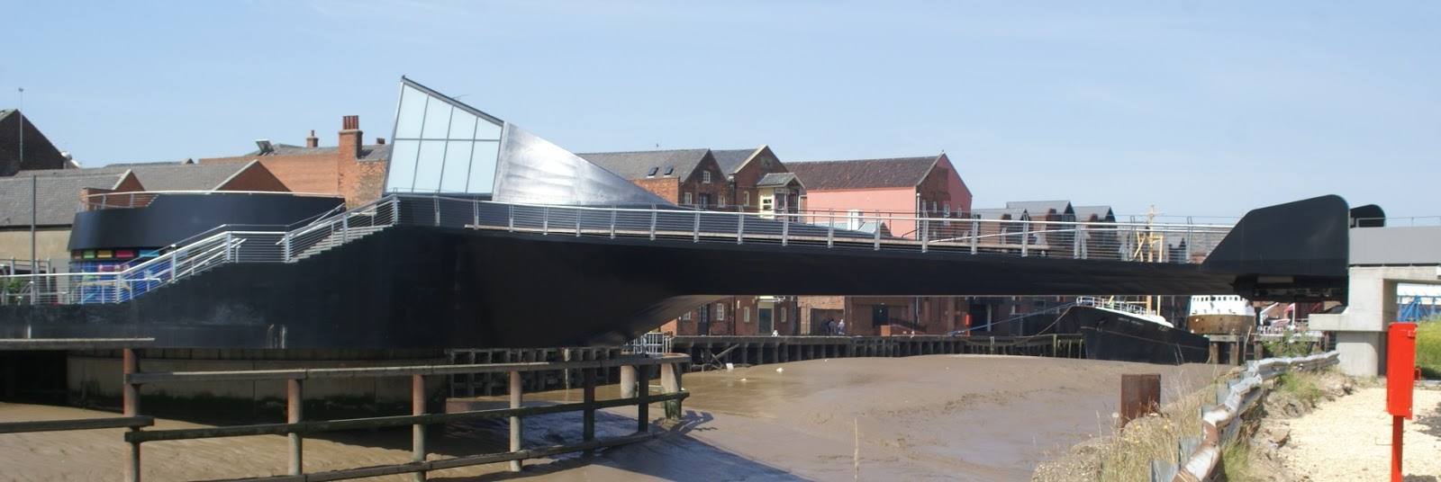
| Scale Lane Bridge, the black part swings |
The new bridge is interesting too. If it opens for river traffic, gates shut at the east end and this end swings around to open for boats, but anyone on the bridge can stay on and people can still get on and off the bridge at the west end. In the middle of the bridge is a building which will be a café eventually and a small exhibition space too I think. These is a sloped cycleway and a flatter footway, except the footway has steps along it. All along the footway there are seats with views looking across the river. It didn't swing open while I was there, but it still looks quite different for a bridge and I like it.
 |
| The Arctic Corsair trawler, now a museum, beside the river Hull walkway |
 |
| The main road crossing of the river Hull and beyond the tidal barrier |
I then took a look at a new development close to home. The Bridgehead development is close to the north end of the Humber bridge. It looks like it will be the usual for commercial buildings: steel structured, clad with glass and shuttering. The first two buildings are under way with room for a few more. The roads are accessible so I grabbed a trace. It is interesting that cycle lanes are being included in the road layouts, since the entrance is off the A15 dual carriageway where there are no cycle lanes. Maybe a new cycleway will join up from the development to the existing cycle lanes nearer the bridge and beyond.