OpenStreetMap has been interesting to me ever since I discovered it. It has led me to new and interesting places, many have been close to home. Like photography it crosses over with other interests, so when you visit somewhere you can map it too. I have added a few nature reserves as I have visited them, but usually mostly in outline, often based on the blend of some photos from a visit and some aerial imagery. The latest Bing aerial imagery makes it easy to mark the boundaries that are obvious.
Across the UK there are wildlife trusts, often each based in a single county. I've been a member of the Yorkshire Wildlife Trust for many years, and I've enjoyed their reserves both old and new, some of which are quite close to my home. I looked recently at their website and realized that their maps include an OSM layer, and naturally the reserves I've added show up there nicely. I say nicely - I actually don't like the way the Standard OSM layer renders them, with 'NR' sprinkled across them. That seems horribly English-centric and some transparent symbol or just a coloured background would be better, after all the name of the reserve will be rendered if possible.
I contacted YWT to say how I liked their use of OSM and was there any way we could work together to make sure all of their reserves appear on OSM. I hope that if we can add them all they would stop showing the Google layer, though an aerial view is useful. I know they need to add OSM attribution too, but I'm sure we can soon work that out.
A reply came back quickly saying they would like to work together and after some discussion we agreed to improve a local reserve on OSM to include as much detail as possible to see if we could not only make OSM better but use the data to perhaps make a purpose-made render for them to use elsewhere.
 |
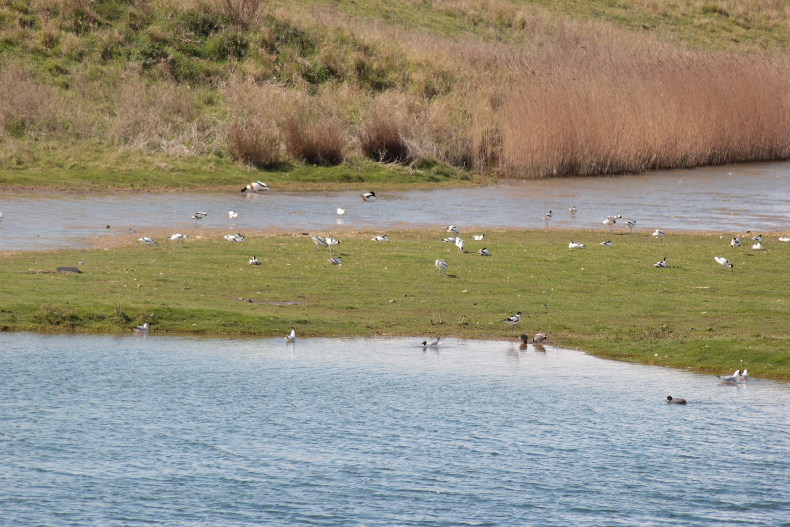
| Avocets |
I have been out today surveying. I did get side-tracked into watching the avocets dancing and calling, but I gathered some useful details too.
 |
| A mound for nesting birds |
A couple of features have made me stop and think. Firstly, there are often rafts in pools and lakes at nature reserves where birds can build nests, gulls and terns use them particularly. They are permanent enough to tag them, but how? I used man_made=pier, pier=nesting_raft for now, but someone might have a better suggestion. The other, slightly less specialist feature, is a mound or embankment. There is a footpath to a hide which lies between two embankments to keep people on the path from being seen by the wildlife and causing disturbance. If the path was on top of an embankment I would just add embankment=yes to the way for the path. If it was in a cutting I could add cutting=yes. I settled on drawing an outline of the embankment from imagery and using the tag man_made=embankment. It won't render on the Standard render, but that's not too important. There is another such mound, but this time for birds to burrow into for nests. I used the same idea to tag it. Rabbits seem to have taken it over.
My next job is to create a custom render for the reserve to see what is possible and I'm going to experiment with TileMill to see what I can produce. In the meantime you can see the latest render of the reserve
here.

5 comments:
I have seen some detailed mapping of wildlife reserves in OpenStreetMap. I'm not sure where but they might have been done by Jerry/SK53, who would be very interested in this topic.
http://www.openstreetmap.org/user/SK53
I'd like to speak to Jerry, but he seems to have moved on from OSM.
I had a go at mapping a nature reserve in detail. It was actually for a friend who was running an orienteering session for a local school so I produced a custom osmarender rule set to make an orienteering style map http://i.imgur.com/p6EOx.png though this would be unsuitable for what you want. The area is summer leys http://osm.org/go/eu6RESDG .
@quantumstate: Wow, bright or what? :-) Summer Leys looks good.
Hi,
This post could become a repository for nature reserves:
http://www.openstreetmap.org/?lat=53.78538&lon=-0.66023&zoom=16&layers=M
Thanks to: http://www.r-pod.ch/dev/wms/?l=r-pod_chavornay_creux_de_terre
Post a Comment